|
Composition
I know what youre thinking; a volcano is made of rocks, duh. Well yes this is true, but not all rocks are the same. Mount Katmai isnt made of the same rocks youre used to skipping on your local pond or lake. No, Mount Katmai is composed mainly of low-silica and low-potassium andesite, with some dacite as well. The most common rock type, however, is two-pyroxene andesite (Sciencedaily LLC). Andesite is a gray to black volcanic rock with between about 52 and 63 weight percent silica, while dacite is volcanic rock that is most often light gray, but can be dark gray to black, consisting of about 63 to 68 percent silica (USGS Photo). There have also been reports of some minerals found on the volcano. Biotite and hornblende tend to be pretty rare, but quartz has been found in some of the upper flows from the volcano (Sciencedaily LLC). Then again, where cant quartz be found, it is the most abundant mineral on the planet (Amethyst Galleries, Inc.).
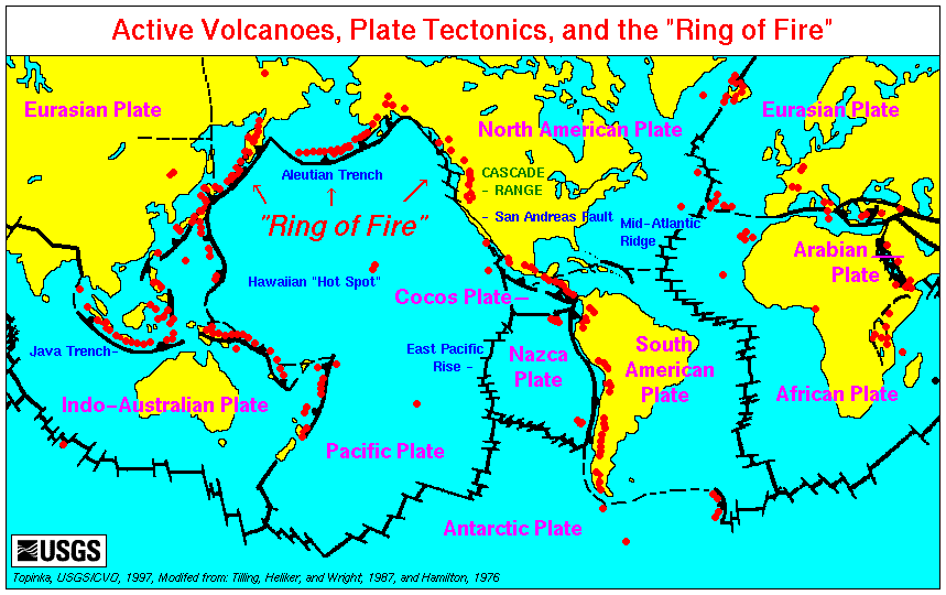
The Ring of Fire (USGS)
Plate Tectonics
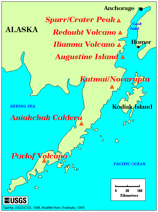
Mount Katmai is located on the Alaskan peninsula, which is in the world famous, Ring of Fire. The Ring of Fire is the area surrounding much of the Pacific plate and it contains 75% of the worlds volcanoes (Crystalinks.com). Mount Katmai is located in a subduction zone. This is where one tectonic plate is actually moving under another plate. In the case of Mount Katmai, the Pacific plate is subducting under the North American plate. This motion of the plates has caused a deep Aleutian Trench to form under the Alaskan peninsula; in fact, the Aleutian Islands are actually growing because of this plate movement. The trench has a maximum depth of 25,194 feet (Crystalinks.com).
Volcanic History
There isnt much to say about the volcanic history of Mount Katmai; that is if you consider the biggest eruption in the 20th century no big deal, because on June 6, 1912 thats exactly what took place at Mount Katmai. Click here to learn about it.
To go back to the homepage click here
|